
Historic Hood River
Still Free
2-10-2016
Notes

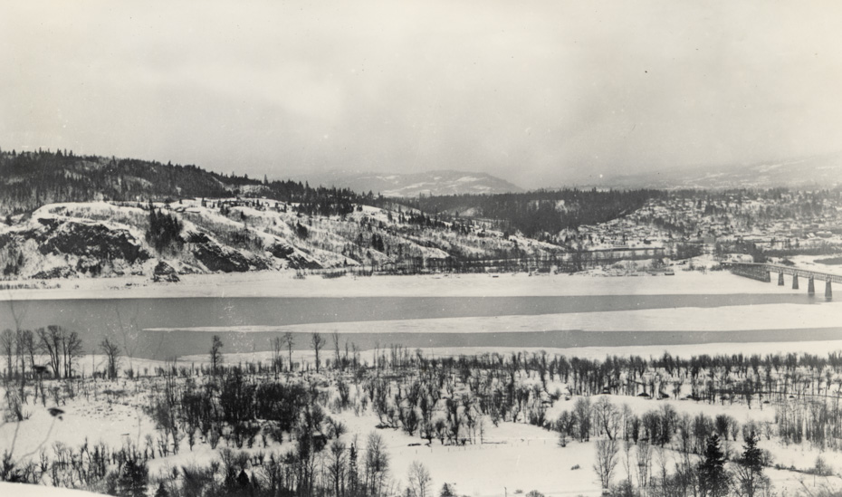
This snowy view of the Columbia near the Hood River- White Salmon Bridge was taken on February 19, 1936. Just a year later Lake Bonneville would start to back up behind the Bonneville Dam, changing the flow of the river significantly. We had a discussion a while back about why the dammed river doesn’t freeze over as easily as the pre-dam river. The basic answer is the turbulence of the free-flowing river allowed the water temperature to drop more quickly, much as a cup of tea cools off faster if you stir it.
Category: default

Longshot
Arthur, looking at the original of this photo, can you tell if any of the buildings shown in image #1325 are still there? It looks like they are but the photo is awfully blurry.
L.E.
I have watched the mystery of rocks at the bottom of a clear and turbulent river, gather ice, before the top of the water surface begins to freeze.
I have heard the claim by Snake River area residents, that their average temperature rose after the dams were in place. I don’t know how you would prove that claim.
Arthur
Longshot, it looks like some of the buildings on the hill near where the gravel pit is now are still there, but the trees have 35 years of growth and are obscuring too much to be sure.
L.E.
I was wondering if the house in #977 is in today’s photo?
Bill P
In the big freezes of 1920 and 1920, my dad tells of walking across the Columbia to Bingen. The river traffic is such today we will never see that.
Bill P
Longshot
Maybe the ruins that are in the bottom right of the 977 photo are what if left of the mill building in the 1325 photo.
Is there a Corp of Engineers map for the Hood River water front showing the area that would be flooded by Bonneville Dam as we have previously seen for Koberg area?
Charlott
My husband and a friend Tom Barney walks across it in the ’50’s when it was frozen over.
spinsur
Yes Longshot, there is Corps mapping on both sides of the river for the entire Bonneville pool that dates to about 1935. County Public Works and most of the local surveyors have the scans of the mapping. There’s even aerial photos available for viewing from that project, that date, at County Public Works.
Arthur
And thanks to spinsur I have copies of all of those maps. I’ll send Longshot the scan, but the area we’re looking at is very hard to read. If anyone else wants to see it email me.