
Historic Hood River
Hood River in Snow
12-9-2013
Notes

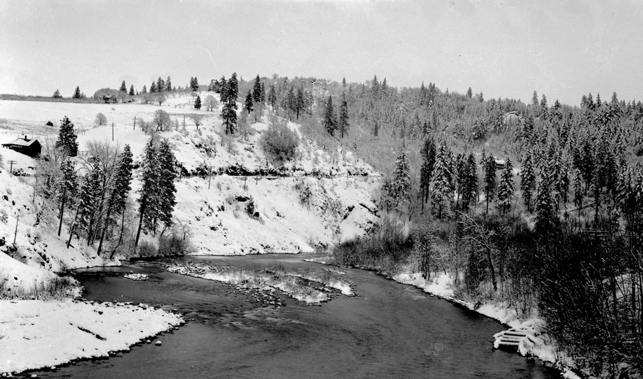
Back to a more seasonal post. This one hundred year old image from the Davidson Collection could have been taken yesterday. I think this is the last mile of the Hood River, just south of the bridge. If I’m correct, that’s the east side grade on the far side of the river.

charlott
Definitely East Side, now Hwy 35 going up there. Interesting how many trees are on the right side of the photo. Is that some sort of a dock there in the lower right, as it looks like some sort of road in the trees.
l.e.
Oh brrrr. Even though it is cold today, that photo looks colder. At least now, in order to travel that grade, we can use a warm enclosed car with a heater, rather than an open wagon or buggy.
The hillside on the left has more trees now doesn’t it?
P.A
I wonder if the photo was taken on the bridge.
Ralph
It looks like there are 3 people on the road near the 2nd pole from the left group of trees.
One seems to be waving and on the outside of the road barrier. Can anyone else see them?
Norma Jubitz Simpson
I have a print of the river taken above the bridge. It was taken by the Riser Bros. in 1903. Looks like it was taken from the end of Prospect Ave (Maude and Al Peter’s back yard) looking toward VanHorn Butte. It shows a large tree covered island in the middle of the river. Today there are just rocks there and a lot less water.
Jill Stanford
Maude and Al Peters were my grandparents Norma – Marguerite Peters Stanford was my mother.
l.e.
I can’t see them Ralph, but it would not surprise me. The Davidson photos often seem to include a happy group of people.
This photo is taken below the bridge.
https://www.hoodriverhistorymuseum.org?showimage=255
I can’t see the house at the top of the hill, but it must be there in that clump of trees.
Arthur
Good find, l.e. I compared the hi-res scans and can match the house, fence line and utility poles, so this is definitely taken from the middle of the old wooden bridge across the Hood River.
steve
More – " I spy "
what is that protruding into the river- lower right- ?
I see a straight line in the trees atop the snow just to the left- ?
Anyone care to ponder…
Buzz
Steve, i’ve seen lashups that looked similar that were used to launch and retrieve small boats from up on a hill into the water. The wooden carrier runs on a track and is hooked up to a mechanical winch that pulls it up and lets it down. At an odd angle to the track–maybe just not in use anymore.
charlott
Norma, Van Horn Butte is out in Pine Grove.
Jill Stanford
Charlott, you could see Van Horn Butte from my grandparents patio. One of his oldest friends used to live on top. There were a lot of trees on it too.
l.e.
I had to look up Prospect Avenue on a map. Looks like it runs east from the HR Middle School up to the bluff overlooking the Hood River.