
Historic Hood River
Columbia River Highway Postcards
6-2-2015
Notes

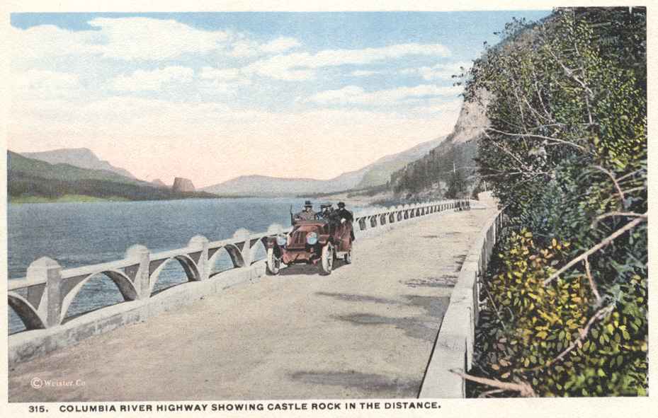
Here’s another in the series of Weister cards of Columbia River Highway scenes. They were printed in Germany and mention Union Pacific railroad on the reverse.
The highway really jump-started scenic photography in the area, creating a ready market of customers eager to remember their trip on the highway by purchasing a selection of cards. Visitors may have brought a camera in their automobile, but these fine color images were beautifully composed by professionals, and printed in Germany by experts in their craft.

L.E.
So….I googled Weister Co. It sounds like we don’t know for sure who the photographer was, because more than Mr. George Weister worked for the company, but many of his photos were used by Union Pacific.
My husband’s grandmother had a selection of post cards and I suspect they were thrown away when her house was cleaned out. She attended the Lewis and Clark Exposition in 1905, so she might have had some real treasures.
L.E.
Does this section of the CR Highway still exist?
Is there landfill out in the river for the freeway?
Scott Cook
Hi all…I’ve been away for a long while…nice to be back in home sweet Gorge! LE, this is the viaduct section of HCRH immediately east of Multnomah Falls. Now you’d see I-84 over the railing. BTW, Beacon Rock had been called Castle Rock before 1916-ish when Henry Biddle completed his purchase of it and petitioned WA to re-name it to its original Lewis & Clark name.
Arlen Sheldrake
Seems the road shrunk over the years,,,,,:)
Longshot
I agree that the picture appears to be taken from just a bit east of Multnomah Falls, but If I am not mistaken the road to the east of Multnomah Falls is a half viaduct, while this picture appears to be a full viaduct. Did the original historic highway sit a bit further north out towards the river and then get cut into the hillside at a later date to give more room for the railroad and interstate?
Kenn
East viaduct , a bit narrow when meeting a truck in "the good old days".
Kenn
Longshot, this is the original location, the two viaducts constructed to avoid the RR. Between the two viaducts the highway is on a curve of the original RR.
Longshot
Kenn, it is partly the lack of seeing the railroad in the picture between the river and the highway viaduct that makes me think that maybe the scenic highway used to be further to the north and run on a full viaduct and not the present half viaduct. With what you are saying about the present road using part of the original railroad grade then this would make sense. Here is a link to the original picture.
http://volcanoes.usgs.gov/observatories/cvo/Historical/LewisClark/Historical/ohs-archives_downstream_beacon_rock_1915.jpg