
Historic Hood River
Industrial Hood River
10-9-2014
Notes

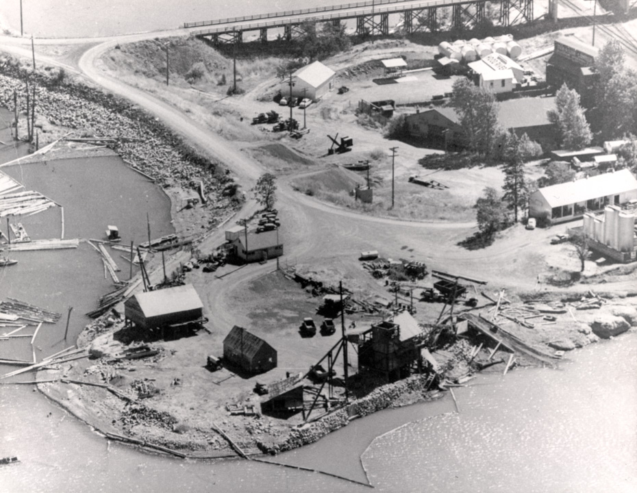
It’s a little hard to get oriented in this one, but we’re looking at the industrial land east of the Hood River, between Button Junction and the Hood River- White Salmon Bridge. Still confused? Look for those tanks in this view.
We’re right over the Hood River, looking ESE, with the railroad bridge just to our right out of frame. Today I-84 goes through the left portion of this image. That bridge now curves to the east to connect with the exit 64 interchange.
That building closest to the tracks says “Tum-a-lum Lumber”.
I’m guessing a date of “1950’s” based on the automobiles.

Charlott
Look at that old steam shovel there in the middle.
Buzz
I would guess this is a pre-50’s picture. And that shovel is probably gas or diesel powered.
l.e.
Anne Markgraf Ward has just published a book, "Klickitat Saga–1805-1859"
I was reading this, which would have taken place somewhere in the area of today’s photo.
Page XXXV
…in The Dalles Weekly Mountaineer of March 31, 1897 and is included here for any light it may shed on the question of whether there were people present in this area before the Bretz floods:—"George Kraus has been digging a well near the end of the Oregon Lumber Company’s flume (at the mouth of Hood river) and at the depth of forty feet discovered a lot of human bones and teeth deposited in a bed of gravel. Sinking the well to a depth of fifty feet he encountered another bed of gravel in which were more bones and teeth. This discovery leads one to inquire where the bones came from and what sort of people did they belong to. The formation in which they were found evidently had not been disturbed for centuries, and the people whose remains were thus discovered must have lived when the Columbia river a mere rivulet and Mount Hood a mole hill."
nels
thanks glenwood. No mention of any archeological investigations with those finds?
longshot
Anyone have a clue as to what the somewhat odd building is in the foreground? and the ramp like structure to the right of it? They both look like they were designed to dump stuff into the river.
Jeffrey Bryant
Bob Vaughan ran a dredge somewhere near this location.
Natalia Dittmer
This is the explanation given to me by Jim Crawford, great grandson of Tum-A-Lum founder J.M. Crawford:
The pictures next to the RR tracks are the old Coal transfer spur line the Company owned back in those days. We sold both stocker coal and lump coal for many farms and orchards which used the fuel for heating. The sign next to the tracks is where the RR cars were unloaded by gravity into storage bins for
transfer to customer trucks. They could back up to chutes which would allow the coal to drop into their pickups. I can recall working the chutes in my early days at Hood River before we built the new yard at the present location. As coal became outdated, we sold the property to the adjacent standard oil Co which, in turn, helped to finance the new yard site. The conception and construction was completed under my supervision in 1979; it has been a flagship yard for the Company ever since.