
Historic Hood River
Bridge House
Notes
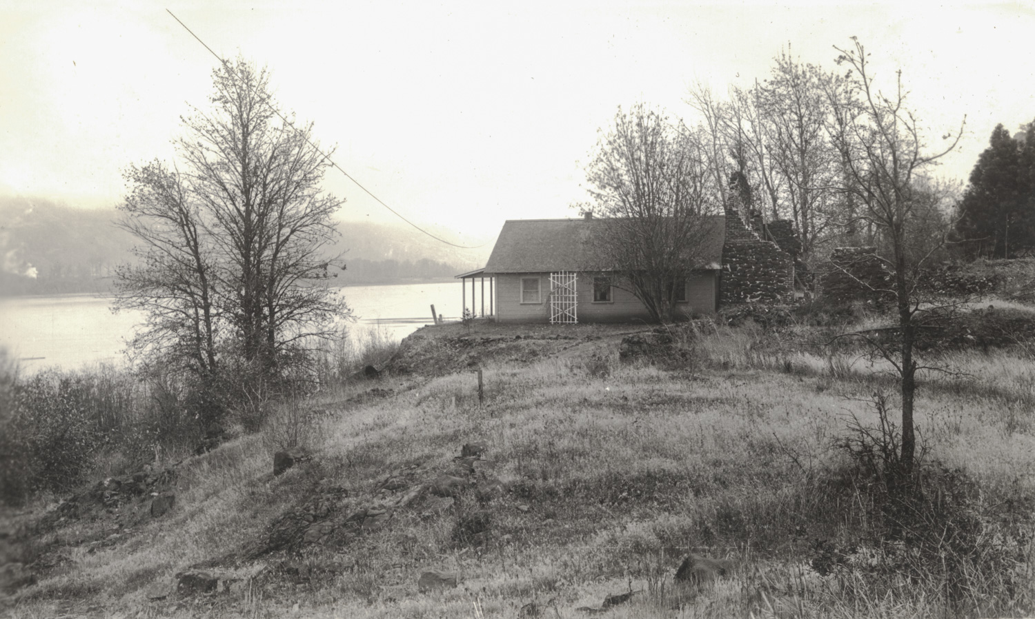
This image is from a large collection of bridge construction photographs from the archives of the Port of Hood River. This view is from an album covering the various reconstruction projects on the Hood River White Salmon Bridge. It’s dated November 29, 1935, which is early in the project to reconstruct the bridge approaches to address the changes in the river flow to follow the construction of the Bonneville Dam.
It looks like this house has had an interesting history. It was built up against the ruins of an earlier structure which looks like it was originally all mortared stone, then rebuilt with some “modern” brick, before falling into ruin. If you look closely you can see someone has erected a tall poll (perhaps a flagpole) in the ruined structure.
My first guess was this was a house they were planning to remove in order to straighten out and raise the Washington approach to the bridge. But after another day of scanning, I discovered a 1939 image from an angle which shows this house was on the Oregon side, just east of the bridge abutment– someplace on what is now the Hood River Inn property.
In 1935 the Army Corps of Engineers did detailed surveys of the land to be flooded with the Bonneville Dam project. I checked the survey for this area and sure enough it shows the house we see, as well as a shed, pump house, shop and “old reservoir” all beyond the house. There is no mention of the original stone structure, presumably because it was not something of value which the project would need to pay for.
I hope we can find out more about the original stone structure. It was already quite old in 1935, so it must be part of the early history of Hood River. It must have been very close to the old mill which was near that spot until about 1904. While the mill itself was constructed from wood, it’s possible the stone structure housed the mill’s boiler.

L. E.
Interesting.
Arthur Babitz
I found a June 1943 image of this house with water lapping at it from all sides. It was quite close to the bridge– maybe 100-200 feet east.
Jeffrey Bryant
I thought some of the buildings down by the river belonged to the native American community, but that house and stone structure do not seem to fit.
Stever
That’s a shaky-looking tall wall next to the home for sure…
I spy ….. A slight pathway perhaps to the left towards the home, A second chimney at the roof line perhaps, A slight dusting of snow perhaps on the roof and rock walls and on distant hills, A puff of smoke across the river, A power source to the home. The home appear built up on some fill material above the normal grade. Perhaps a railroad grade to the far right and a very large tree growing right up against the home perhaps helping to date the age of the structure. The flag pole does appear propped up tight into the corner with another support.