
Historic Hood River
Sanborn Maps
Notes
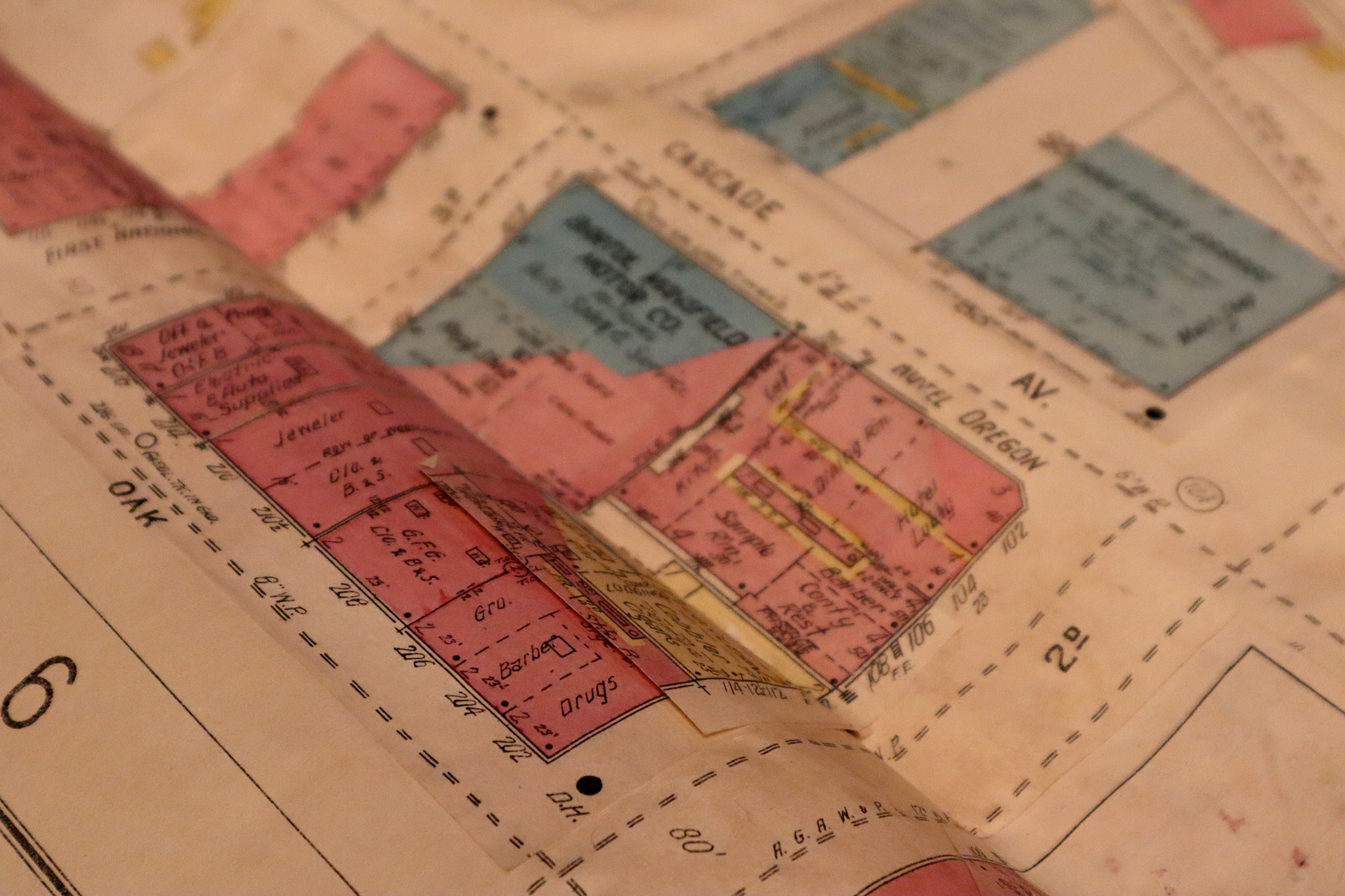
We’ve talked about Sanborn maps many times but Morganne thought you should see one of these wonderful maps from our collection. These information rich maps were prepared every few years for fire insurance purposes. Insurance underwriters could examine the maps to learn relevant facts, such as building material, building structure, use, water supplies and sources of combustion (like boilers and furnaces).
Sanborn maps for Hood River were published in 1893, 1902, 1905, 1909, 1916, 1928 and 1942, but as you can see here subscribers received regular updates they could physically glue into their map books as tenants change or new buildings are developed. This 1928 or 1942 map showing the corner of Oak and Second Street has two such updates pasted to it. Bill Pattison told me his first job in the insurance industry was pasting updates into the maps. I wouldn’t be surprised if he was the one who applied these updates.
It takes some training to read extract all the information from these maps. This one tells us the west part of the Brosius Building (NW corner of Oak and 2nd) was split into three shops on the ground floor: a drug store, barber shop, and grocer at 202, 204, and 206 Oak Street, each 23′ wide. It was a two story building with metal, late, tile or asbestos roofing material (the single dot), and storage in the basement. Second Street has an 80′ right-of-way and there is a double fire hydrant on the corner, with an 8″ water main down Oak and a 6″ main down Second. It also shows the 12″ AGA owned pipe running from the Wilson Reservoir to the Union Building.
These maps are invaluable in dating photographs. The structural information combined with the tenants is often enough to match an image to an address and a narrow date range.
If you are interested in examining these maps in more detail, you can download the 1893- 1916 maps from the Library of Congress website. It takes some time to become fluent in the abbreviations and symbols, but you’ll still learn much about the commerce in Hood River (and Cascade Locks too!) during a specific era.
[ed. note: I’m experimenting with increasing the resolution of HHR images, so you should be able to zoom into this a bit in your browser)]
Tags: 2nd Street, Brosius Block, map, Morganne's Mondays, Oak Street, Sanborn

Jeffrey Bryant
I recently used the Sanborn maps for Hood River, along with newspaper articles, to show that the Oak Apartments were a remodel of the original United Brethren church and gymnasium, not a new build. The church was built in 1891, making the Oak Apartments one of the earliest structures in Hood River.
nails
Was there not a gymnasium associaated with that church?
Jeffrey Bryant
The gymnasium was the north half of the Oak Apartments/United Brethren church. It was built after the south half.
Jeffrey Bryant
Maybe Arthur can add a link showing the UB church on the Sanborn Maps.
Dale Nicol
Yesterday when I saw the insurance map with the red and blue colors, it finally jogged my memory….this was the beginning of “ultimately redlining neighborhoods” and was outlawed in 1968 with the fair housing law.
Arthur Babitz
On this map the colors refer to the type of construction. For example yellow is wood frame, red is brick, blue is concrete or concrete block.
Dale Nicol
Thanks Arthur but over the years, it led to the red lining to of neighborhoods.
Jeffrey Bryant
I see that the California State University Northridge has a collection of Sanborn maps that includes Hood River 1928 and Cascade Locks 1915.
https://www.csun.edu/sites/default/files/outside_california.pdf
Arthur Babitz
Yes Jeffrey– We have copies of the 1928 and 1942 map at the museum. The 1942 one is really a 1928 map with some revisions but since it was the last Sanborn of the city it is very useful.