Historic Hood River
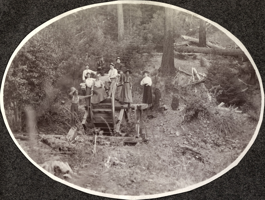
Waterwheel
8-22-2017
Notes

This waterwheel is something of a mystery. Where’s the water?

The History Museum of Hood River County
Bringing the Rich History of Hood River County to Life
This waterwheel is something of a mystery. Where’s the water?

L.E.
I am on my iPad so cannot get a good perspective, but it looks like fir and brush so probably not a mining set up in eastern Oregon?
One thing I notice are the downed trees, which were an everyday travel hazard in the team and wagon days. Quite often a new road was made by trying to detour around.
The man on the wheel, in the middle is a regular in the Conser photos.
Kenn
The blades indicate a typical overshot wheel which would need a flume to the top that is either burned, rotted out or abandoned for lack of water.. Wonder what it powered ~
Longshot
There were two ditches which were used to transport water out of Polalie Creek and head it down into the upper valley. One ditch was maybe thirty feet in elevation higher up the slope than the other. If I remember correctly just before the ditches reach Doe Creek the upper ditch dumped into the lower one which continued on carrying the combined flow across the creek on a trestle.
I am going to take a wild guess and say that this wheel sat between the upper and lower ditches and generated power from the water flowing from one ditch to another.
Kenn
Longshot, so logical and probable, thanks for your thoughts ~
Arthur
I think LE is probably right about this being Eastern Oregon. This part of the album seems to be years after Earl left his railroad job and went to work as a banker.