Historic Hood River
The Dalles Waterfront
11-9-2018
Notes

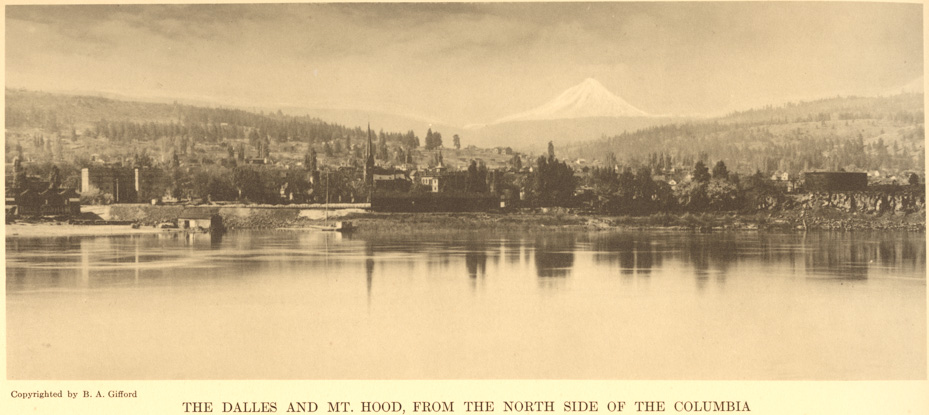
This is a classic Benjamin Gifford view of the Dalles waterfront during the era when he had a studio there.

The History Museum of Hood River County
Bringing the Rich History of Hood River County to Life
This is a classic Benjamin Gifford view of the Dalles waterfront during the era when he had a studio there.

L.E.
Where B. Gifford is standing, on the Washington side, is a flat landscape of rocks that appears to have pushed the Columbia R. south, creating a large bend in the river at The Dalles.
Anyone know what geological happening created the landscape?
Kenn
St Peters church shows well. Cannot imagine the house at waters edge lasting through a winters high water. Was hoping to see the south side ferry landing but cannot pick it out, still obvious on the north side and used for fishing.
Dan K
Thank you Arthur for the great talk last night.
Arthur
Sorry I didn’t see you there Dan. I guess the light was in my eyes.
L.E.
I think the rock bank at the right of the photo is where Fort Rock is located, where Lewis and Clark camped in 1805 and 1806. They were just downstream from the mouth of Mill, (Quinnett) Creek. Hunters went up the Creek to obtain venison for the party.
Indians came over from the Washington side and Pierre Cruatte entertained them with his fiddle.
On the return trip, they remark on the change in climate and the drier air.
Charlott
I am thinking the house on the water front is actually a shed, having something to do with fishing or boating.
Charlott
The mill on the left portion of the photo appears to me to be too close to the downtown area and the big church to be what we call Sunshine Mill.
Does anyone have a clue as to what the big rectangular building is on the far right?