
Historic Hood River
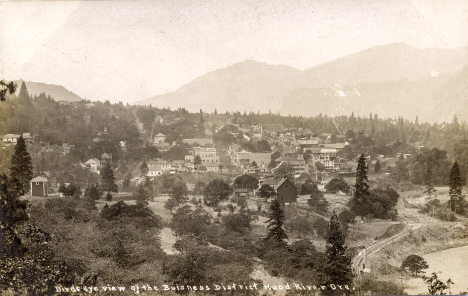
Bird’s-eye View of the Business District
10-10-2016
Notes

I’m not sure if I’ve shown this early postcard before, but it’s a great one to observe the changes over time. This predates the Columbia River Highway– a post 1920 view would show the bridge over the Hood River, and all the tourist amenities (gas stations, garages, etc.) on the east end of town. We see the old Victorian OR&N depot as well as the Mt. Hood Railroad depot, which limits us roughly to 1905-1910. The brick annex to the Mt. Hood Hotel hasn’t been built yet, nor has City Hall and many of the brick buildings downtown. Billboards painted in the sides of wood frame buildings promote competing brands of cigars. I see “Bull Durham,” “Owl” and a third one I can’t make out.

Charlott
Good photo of the Button farm area. I wonder what that very huge building is at the very top of Cascade?
Kenn
First I have seen of the RR going into the tank farm east of highway 30, I had assumed the siding there was the original mainline. A semaphore is shown about where the present tank is located indicating clear track to the station.
Arthur
Charlott, I’ve been wondering about that large building on Cascade too. The Sanborn map from 1909 has a warehouse for Stanley Smith Lumber at 6th & Cascade, and a carpenter shop with a roller rink upstairs at 9th and Cascade. In 1905 the building at 9th & Cascade was a planing mill, window sash and door manufacturer. That was a 2 story building, which seems to match what we’re seeing.
Longshot
What info is there on the Button Farm. Not much flat land or even decent grazing land that close, about the best would be the bottomland on out towards Koberg Beach
Libby Bickford
Cascade was the main drag back then?