
Historic Hood River
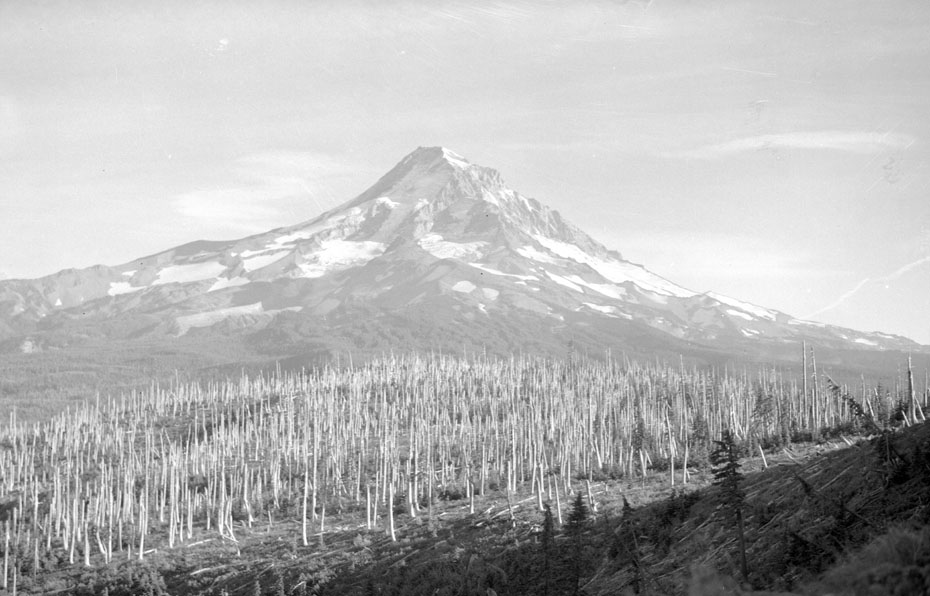
Red Hill, 1952
9-11-2012
Notes

As we struggle through another season of forest fires this image can offer some perspective. This view of Mt Hood from Red Hill shows the area starting to come back after a fire. These trees have now had 60 years to grow– anyone care to find this spot and check out the growth?

l.e.
Are the dead snags still there or have they fallen?
charlott
I would venture a guess that in 50 years they would have rotted out, fallen and new timber would have taken their place.
James Holloway
This must be somewhere south of Mt. Defiance, looking of course east, southeast……..although this is a guess……
Mr. Breeze
Zig Zag Fire
charlott
If this is Red Hill it would be west of the Parkdale area. There was a fire look out at one time on Red Hill and I know on numerous occasions that the Crag Rats went in there for snow surveys.
Buster Gibson
AGREE
Tom Kloster
Terrific photo! I know exactly where this is: just below the viewpoint now known as Owl Point, which is a rocky outcrop on the ridge between Perry Lake and Red Hill, just off the Old Vista Ridge Trail. The forest in the foreground has largely regenerated, though a number of open beargrass meadows remain throughout the area.
I’ve got some recent photos on the web that I can point to, but I think the anti-spam filter on this site is blocking links..?
Tom Kloster
Aha! That does seem to be the problem. You can view some present-day photos by pasting the following links behind the conventional www:
This view is from 2011, a couple weeks before the Dollar Lake Fire:
splintercat.org/PortlandHikers/110808OwlPointTrip03.jpg
This view is from 2012, with the fire zone showing up in the distance:
splintercat.org/PortlandHikers/120823OwlPoint.jpg
And finally, this is purported to be the Red Hill Guard Station & Lookout, circa 1950 – can’t verify that, but it does look right to me:
splintercat.org/PortlandHikers/1954RedHillGuardStation.jpg
Thanks for posting!