
Historic Hood River
Bridge Piers
7-19-2017
Notes

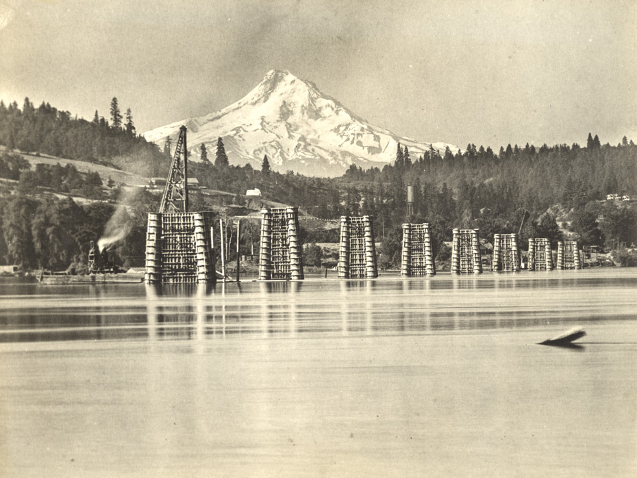
I’ve shown many pictures of the construction of the Hood River White Salmon Interstate Bridge, but I don’t think I’ve shown this one before. It looks like they’re making good progress with the main piers. All of you photographers know it takes a bit of work to line up this shot.

Charlott
Look at that old water tower over there at Powerdale. You can see where Hood River Sand and Gravel is located. Might have been pre Ledbetter’s. Just above that where the bright white roof is, was where Wallace "Fibber" Magee lived when I was growing up.
Kenn
I wonder when telephoto lenses were first devised or used ~
Kyle
Telephoto lenses were not too different from telescopes, which predate plates and film, of course. What made them cheaper and easier to design and make was smaller negatives like 35mm that got popular in the 1930s. Smaller the "sensor", the smaller the lens. Also, the longer the lens, the larger it makes the background appear, hence Mt Hood looking like a hulking brute back there.
Lining up shots like this, I always call "threading the needle" in my head. You’ve got two or three different elements you want to arrange in a straight line, and they’re miles (50 or so in this case) apart.
Arthur
I’ll add to Kyle’s note– the smaller film formats which made telephoto lenses practical depended on film processors having enlargers which allowed them to make prints larger than the original negatives. In the glass negative era "contact prints" were the norm, where the paper was exposed in contact with the negative so the print was the size of the negative. With an enlarger, a 35mm negative could create a 5×7 print, making photography more economical.
When I zoom in to share a detail on an old photo with you, it is very possible the original photographer never got to see that detail. Old negatives hide lots of detail which wasn’t used or appreciated in their day.
kmb
The bridge was built before Bonneville Dam. Anyone know how much the river level was raised at the bridge after the dam was built?
ArthurB
The river level used to vary quite a bit more, but I believe the mean level increased by about 20 feet with the dam. The bridge was raised in a major reconstruction in the late 1930s and the lift span was added to account for the increased height of the Bonneville pool.
Stever
Great to see the " incline " of the slope prior to excavation near the homes in the picture. Sorta of opposite of the Washington shore line – also called the Bingen Gap-
Thanks for also identifying the bridge as the " Hood River – White Salmon Bridge " as it is identified by the Port of HR- but not so much by ODOT or WSDOT or on Google Maps or Wikipedia.
Arthur
Interesting comment about the bridge name. Stever. I use the name from the era of the picture. I would think it’s the Port’s call as to the current name. I’m surprised to see ODOT and WSDOT using a different name. I thought the "Hood River Bridge" is the US30 bridge across the Hood River.
Kenn
A assume that is a concrete "batch plant" on the left, the concrete boated out to the crane for pouring ~
Jeffrey W Bryant
Progress in constructing the bridge in 1923 was reported in the Hood River Glacier. For example:
https://oregonnews.uoregon.edu/lccn/sn97071110/1923-12-27/ed-1/seq-3/