
Historic Hood River
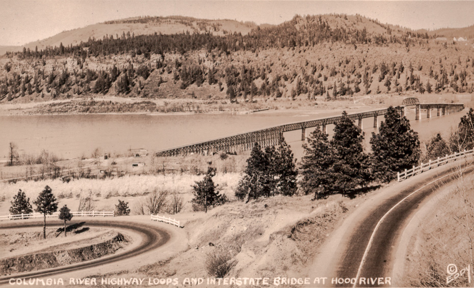
Columbia River Highway Loops and Interstate Bridge
4-8-2020
Notes

This Eddy postcard was glued into one of Olga Plog’s albums from the 1920s. It’s an unusual view which shows how much has changed in the port area at the southern approach to the bridge. I’m also amazed by how little construction is visible on the White Salmon bluff or Strawberry Mountain. Also, check out the dock at the end of dock grade.

Kyle
Old Highway looks basically the same.
Kenn
Obvious how much more oil cars dripped gong up grades
Andy B
Oh wow, great photo! Over on the Washington side, is hwy 14 in place yet? And the train track? It looks like maybe there is a road grade there but I can’t tell.
The east side road looks about like it does today!
Norma
What I remember most about the loop highway was hay trucks from Eastern Oregon on their way to Portland. Many a load was lost on the sharp corners.
kmb
The view today of the Washington side looks much more treed than what you see in this photo. Is this because the area had been partially logged back then? Or is there some other reason for this difference over time?
L.E.
Ralph Brown has a Facebook page called The Early Years of White Salmon and Surrounding Areas. Right now he has a a photo of a 1923 Sunday Oregonian drawing of proposed north end bridge approach, dock grade and the White Salmon docks.
https://m.facebook.com/groups/413048905733310/
Rawhyde
I believe that left tree inside the lower loop is still there and about 20" in diameter now.