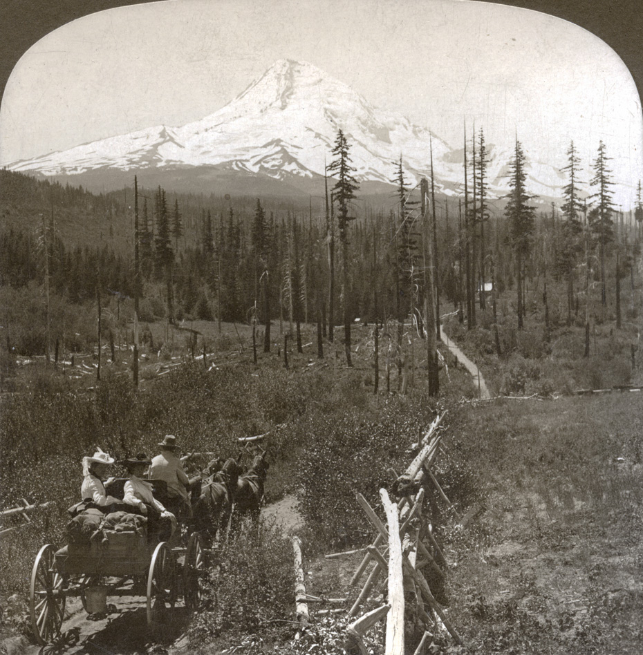
This H.C. White Co. stereocard image is captioned, “Mt Hood, one of America’s most noble peaks.” A hand written message on the reverse identifies it as the “road to Dee.”
I think the scenery in this photo makes Charlott’s and Arthur’s guess about the photo two days ago in the Dee area, a reasonable guess.
L.E.
Another question. How long would the team have to stand there while the photographer prepared the camera?
lee
I can’t see that this is on the way to Dee as the only place on Dee highway that you can see the Mt. is at Dee Mill looks more like the east side or Parkdale view.
Buzz
Fence appears to be an appropriate pasture enclosure for the homestead featured in the photo of a few days ago. Maybe the ladies are off to a tea in Dee.
Dan Kleinsmith
Looks like the road that heads south out of Dee on the west side of the river. That area looks like it could be the same spot where they sometimes hold bee hives
L.E.
Something to think about…. Dee wasn’t called Dee until 1906 and at that time a mill was being built.
Charlott will know this history better than I, but Cloud Cap was built 1889 and Winans built a hotel in the 1880’s and Odell settled in 1861. This area was fairly well traveled in the early years.
val
I believe this picture was taken when you first turn onto laurence lake rd. About the same area as the big field.
I took a picture of that field (what we called the old Dude Ranch)looking to the MT. similar- but this seems to be above the field-maybe around the corner from the settling pond-where the wash out came thru"¦Or- off of Red Hill area/ Bear Cr side.


L.E.
Where would the well dressed ladies be headed to?
I think the scenery in this photo makes Charlott’s and Arthur’s guess about the photo two days ago in the Dee area, a reasonable guess.
L.E.
Another question.
How long would the team have to stand there while the photographer
prepared the camera?
lee
I can’t see that this is on the way to Dee as the only place on Dee highway that you can see the Mt. is at Dee Mill looks more like the east side or Parkdale view.
Buzz
Fence appears to be an appropriate pasture enclosure for the homestead featured in the photo of a few days ago. Maybe the ladies are off to a tea in Dee.
Dan Kleinsmith
Looks like the road that heads south out of Dee on the west side of the river. That area looks like it could be the same spot where they sometimes hold bee hives
L.E.
Something to think about….
Dee wasn’t called Dee until 1906 and at that time a mill was being built.
Charlott will know this history better than I, but Cloud Cap was built 1889 and Winans built a hotel in the 1880’s and Odell settled in 1861.
This area was fairly well traveled in the early years.
val
I believe this picture was taken when you first turn onto laurence lake rd. About the same area as the big field.
val
http://www.panoramio.com/user/4822990?photo_page=1
Beth Hukari
I took a picture of that field (what we called the old Dude Ranch)looking to the MT. similar- but this seems to be above the field-maybe around the corner from the settling pond-where the wash out came thru"¦Or- off of Red Hill area/ Bear Cr side.