
Historic Hood River
1969
Notes
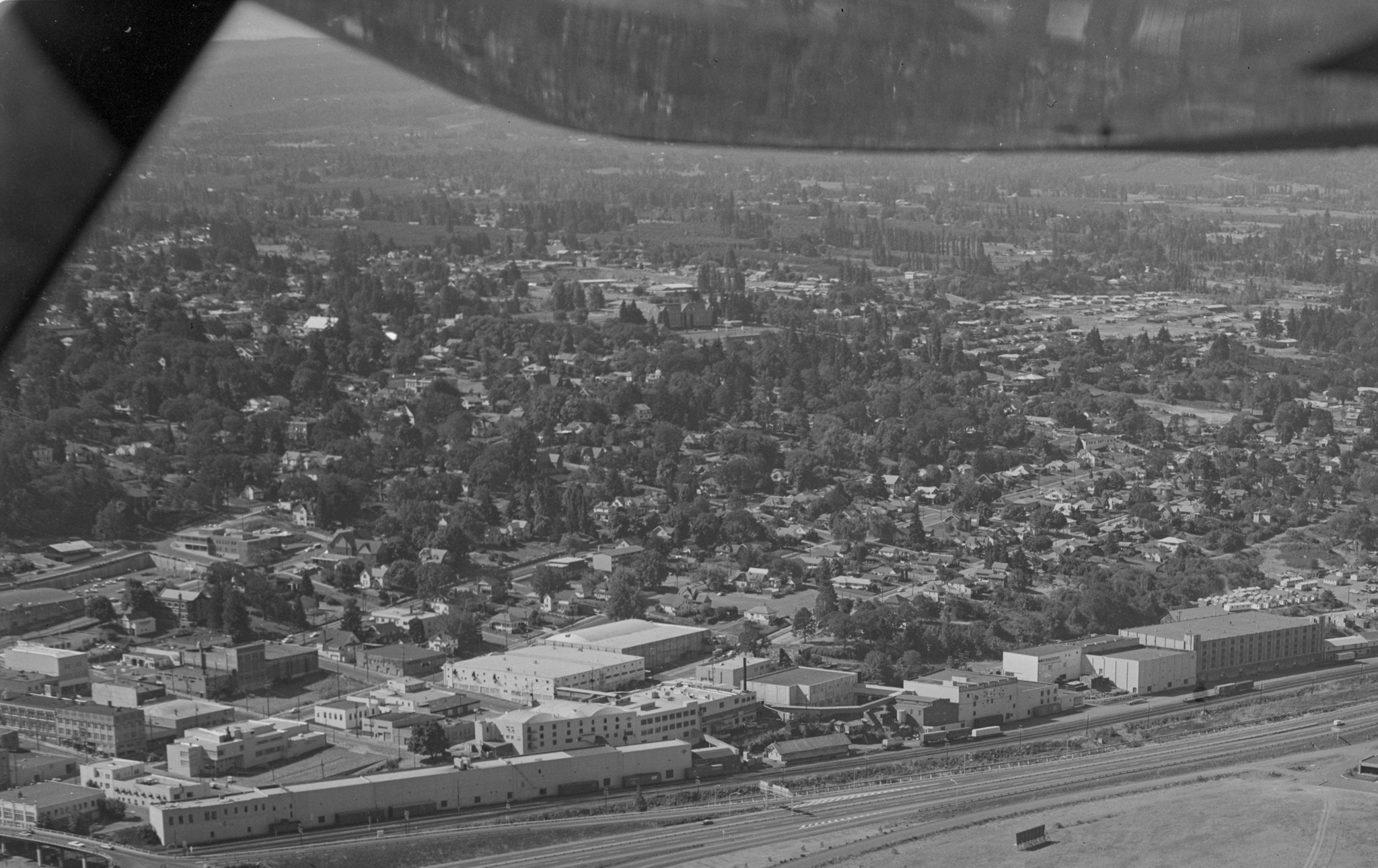
I cropped this aerial view so you can focus on a chunk of downtown. As a special treat, I’ve also uploaded the full resolution scan so you can waste your whole morning on it.
This one is dated September 14, 1969. The very lower left corner is the Second Street overpass. Moving up the left edge you can see the Heilbronner Building and the First National Bank Buildings along 3rd Street, the Paris Fair on Oak, and then the Safeway/HR News building on State Street, across from the library. Its deeply excavated parking lot pops out of the image. It was built sometime between 1964 and 1968 based on my recent studies of aerial images.
This image also has a great view of the industrial properties along the railroad tracks, from the Union Building on the left to what we now call the Waucoma Center on the right. There are a bunch of buildings clustered around the Waucoma Center which were removed when it was gutted and rebuilt a few decades later, converting it from fruit storage to office space (initially United Telephone’s offices). There is a whole village of tiny houses across Wasco Street from that building. They look like they might be temporary housing. Can anyone tell us the story behind those buildings?

Will
Pertinent to the full resolution scan: 30 minutes of research led me back to HHR: https://www.hoodriverhistorymuseum.org/port-of-hood-river-harbor-1962/
L. E.
I don’t even live in Hood River and I find this fascinating.
Is the old high school and football field in the middle of the photo?
The full resolution scan is very thought provoking on how much the mouth of the Hood River has been changed.