
Historic Hood River
Patience
Notes
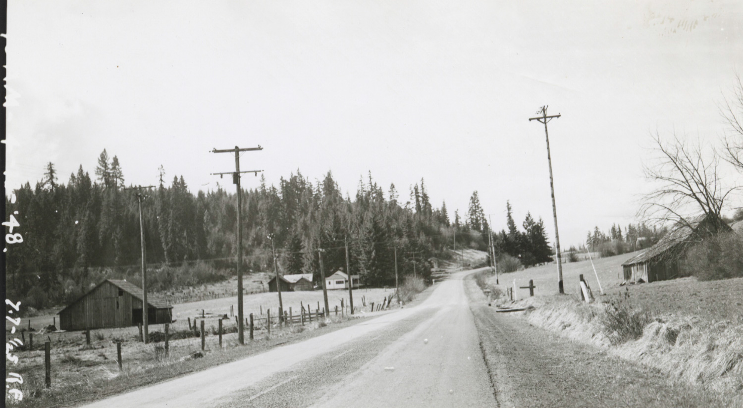
I posed this mystery location to the group seven years ago and you came up with some solid answers, but now we can take it one step further. We have Alva Day own identification, including some detail about why he captured the image (L.E. was basically right– it was the power lines).
Our Alva Day collection consists of 2500 negatives which have all been scanned, and a couple of hundred prints of the same negatives which have only been partially scanned. While you can usually get a much better scan directly from the negative, the prints can also be valuable– especially when they contain notes on the back. While this print is not exactly the same view as the 1947 negative we saw in 2017, there is no doubt it is the same location a year later. Alva Day’s notes tell us,
Looking south on the Mt. Hood Loop Highway from a point in the SE 1/4, NE 1/4 of Sec.10, T 1 N, R 10 E, showing the Co-op line crossing Highway and Company lines. No side guy on 50 ft. pole. Near Mooney property.
So Day’s focus on this spot was because it was where the Hood River Electric Coop lines crossed the Pacific Power lines. Day worked for Pacific Power. I imagine managing this crossing would have been important to keeping the peace between the two electrical service providers.
Here’s a quick and interesting lesson on the origins of the “Public Land Surveying System” and how it works. You can put that knowledge to use by searching for this spot on the Hood River County Webmap. Just make sure you turn on the “Oregon Public Land Survey” layer to see the section lines. Zoom in to 01N10E10 (section 10 of Township 1 North, Range 10 East), then mentally divide that section into four parts. Choose the northeast quarter of that section, as Alva Day wrote, then mentally divide that quarter section into four parts and select the southeast quarter of that quarter section. You’ll find yourself just south of the Sawtooth Roadhouse, at the Hanel Mill, just north of Neal Creak Road.
We also have the negative which matches this print. I am able to search our photo database for 1948 Alva Day negatives this pops right up. The negative has much more resolution and range, so I can easily read the obscured notes on the left side. It says, “10:15 AM 4-13-48 7.7- 1/25”. In addition to the time and date he recorded the aperture (f-7.7) and shutter speed (1/25th second) of his camera. This is a pretty wonderful level of documentation for an obscure dot on the globe at an otherwise insignificant moment in time.
Tags: 1940s, Alva Day, electricity, Hanel Lumber Company, Mooney, Mt Hood Loop Highway, Neal Creek Road, Sawtooth Roadhouse

Will
It appears that the barn on Neal Creek (far left) is still standing.
Matt Alley
It appears to be taken from about where highway 35 meets Neal Cr. Rd today. I work at the lumber mill that is there today as I write this (during a break in the action, boss, I swear) and can see the tip of the barn from where I sit in my machine. That barn and ridge behind are unmistakable
Arthur Babitz
Thanks for the first hand account Matt! Good to see all the pieces fit together.
P
When I volunteered for the museum in the photo department years ago, I knew exactly where this was. I went to take precise “after” photos, for this blog, even standing on the remains of the original highway. The house was still there at the time too. You denied my submission. Oh well!