
Historic Hood River
Centennial Week
Notes
This would be a good week to become a Museum member. On Thursday I will be giving a talk on the history of this bridge at a “members only” opening reception for an exhibit honoring the bridge centennial. That will be an early start to the festivities this weekend, including the Centennial Celebration on Sunday which will include a parade of old cars across the bridge and an opportunity to walk the bridge for the first time in decades. The actual anniversary is December 6, but the Port thought they would roll the dice on better weather this time of year. The 1924 bridge opening celebration was a very brief affair due to bad weather, with plans to have a more significant celebration the following summer when weather would more likely cooperate. It’s not clear if they ever had that celebration.
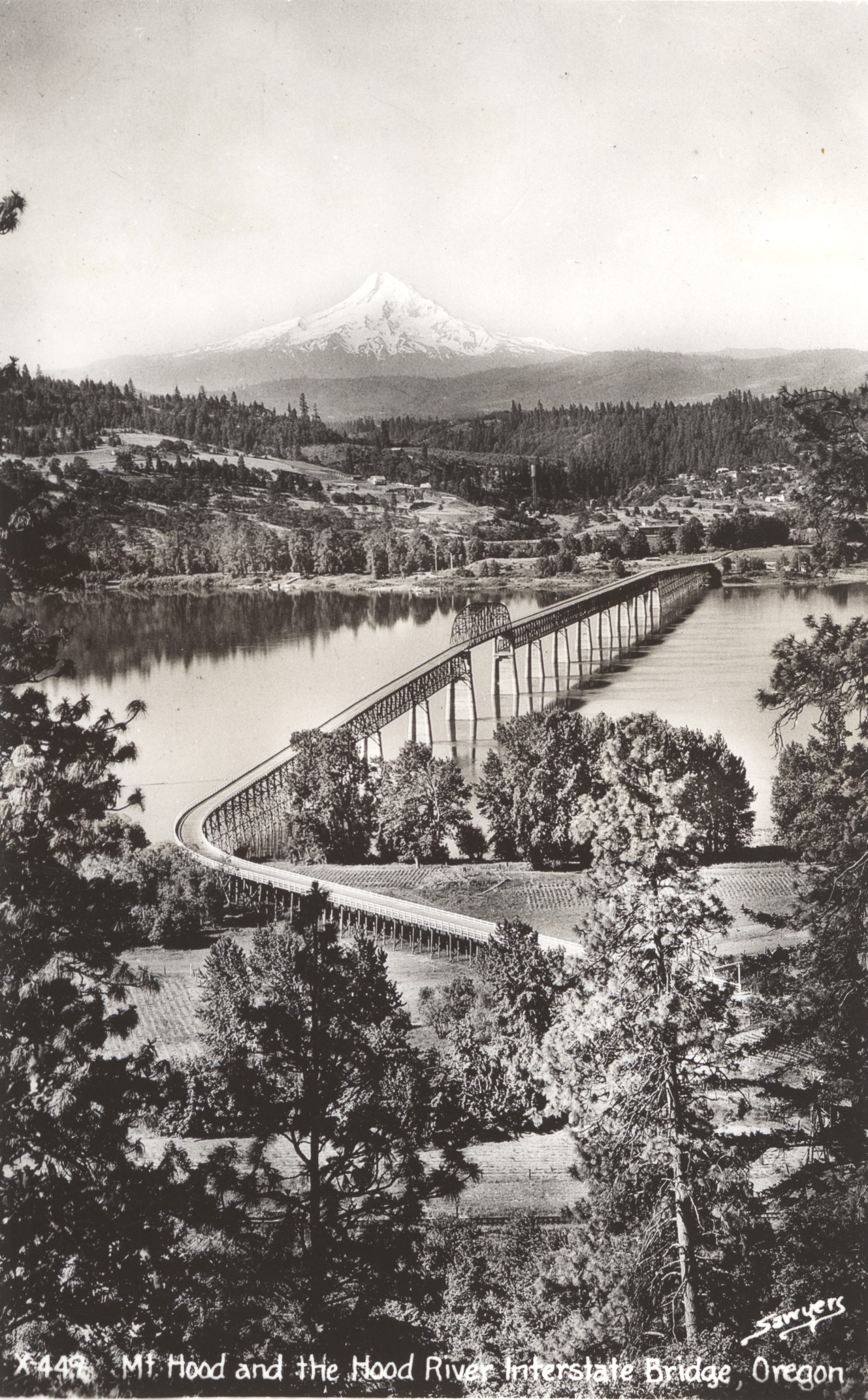
When the bridge was constructed in 1924, they took some shortcuts to save money. They used wood instead of steel for the decking, and they used wood piers and wood trusses for portions of the north and south approaches. You can see the extent of the wooden structural elements in this original blueprint. In this postcard view, the “temporary” parts of the bridge are the ones without concrete piers.
They knew the wood would not last, but they planned to replace it when they had collected enough toll revenue. The Bonneville Dam project appears to have saved the Hood River White Salmon Bridge Company a bit of money, as they had to replace many of the wooden supports to raise the roadway, presumably paid for by the Bonneville Dam project.
You can think about the 1936-1940 reconstruction as having two pieces: The north (Washington) approach needed to be wholly replaced (from the central span all the way to the shore), since it landed on land to be flooded by Lake Bonneville. The central span (crossing the shipping channel) needed to be modified by adding lift towers so it could be raised when ships needed additional clearance to pass under it.
If you look at this image, you can see the original north approach dropped quickly from the central span, and turned to the west as it approached the landing south of the current fishing site. It needed to be replaced with a higher roadway going straight north from the central span, crossing the railroad and meeting the state highway. To accomplish this they had to extend the two existing concrete piers to meet the new higher roadway, and they built the rest of the approach with new concrete piers and steel trusses to support the roadway. About 80% of the northern part of the bridge was replaced in the 1930s. The original wooden north approach was abandoned, though the geotechnical survey conducted last year did find some signs of the original wooden piers and pilings.
The lift span was created by reinforcing the two piers on either side of the central span, adding towers to house the lift mechanism, and adding anchor framework on the central span so it could handle the stresses of lifting it. So while there is quite a bit of new steel and concrete added to the central span, the 1924 span is still there.
Continuing south from the central span, there is a section including seven concrete piers which is substantially untouched from 1924. I believe the piers and the steel roadway supports are original. Then you can see where the concrete piers end and the roadway pitches downward more steeply: that section was constructed entirely from wood in 1924. This image shows that wood section was still in place during the flood of 1948. My best guess it that section was rebuilt with concrete piers and steel roadway supports in 1951, when the bridge decking was replaced with steel grate, or perhaps in the 1960s when the Hood River port project reconfigured the area around the bridge abutments.

Dale Nicol
Arthur, wonderful photo and thumbnail of the history.
Will
Interesting – Sawyers was a photographic studio located in Portland. Sawyers was the nation’s largest producer of scenic postcards in the 1920s and became the launching pad for View-Master in 1939.
L. E.
This Sunday, October 6th there will be a Pioneer meeting in Glenwood. One of the presentations will be on the Mt Adam’s Hwy from Glenwood to Yakima Valley. The plan was in effect around 1910, but in 1924 there was a big push from Portland and Hood River businessmen to complete the highway in connection with the opening of this bridge.
The road crossed the Yakama Reservation, which is what eventually defeated the project.